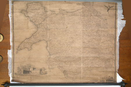
Map of North Wales
John Evans (1723 - 1795)
Category
Maps
Date
1795
Materials
Paper, linen and wood
Order this imageCollection
Dunham Massey, Cheshire
NT 937729
Summary
Large, rectangular, shallow, linen-backed paper map (unvarnished) of North Wales by John Evans. 'To Sir Watkin Williams Wynn Bart. Member of Parliament, Lord Lieutenant and Custos Rotulorum of the counties of Denbigh and Merioneth, Colonel of the Ancient British Fencing Cavalry, Steward of the Hundreds of Bromfield and Yal, and Vice President of the Welsh Charity School. This map of the six counties of North Wales is most humbly inscribed by his obedient humble servant John Evans'. The dedication appears below a drawing of a church in the bottom left corner, and a further drawing and the scale appear in the bottom right corner. The map is torn around the edges and has six clearly visible fold marks. It is becoming detached from the wooden roller with decorative finials at the bottom.
Provenance
Stamford collection; devised to the National Trust by Roger Grey, 10th Earl of Stamford (1896-1976).
Makers and roles
John Evans (1723 - 1795), cartographer

