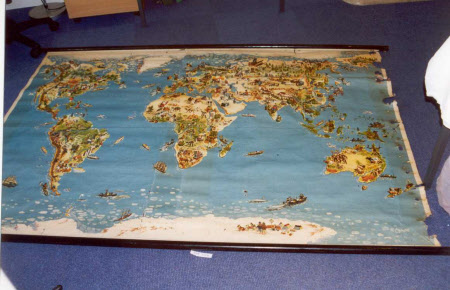
Westermann's pictorial Map of the World, No.571, The human habitat
Georg Westermann Verlag (1810 - 1879)
Category
Maps
Date
Unknown
Materials
Paper, linen and wood
Measurements
2000 mm (width); 1350 mm (height)
Place of origin
Braunschweig
Order this imageCollection
Sudbury Hall Museum of Childhood, Derbyshire
NT 670028
Summary
Westermann's pictorial maps, No.571, The human habitat. A large wall map on rollers showing a map of the world with pictures of people and their lives in different countries. The surface is not varnished. Damp has affected the right hand side of the map causing a series of large holes down the side.
Makers and roles
Georg Westermann Verlag (1810 - 1879), engraver and publisher
