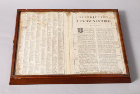
Map of Lincolnshire
Jodocus Hondius the elder (1563 - Amsterdam 1612)
Category
Maps
Date
1630 - 1670
Materials
Glass, Mahogany, Paper
Measurements
385 x 515 mm
Place of origin
Netherlands
Order this imageCollection
Gunby Hall Estate, Lincolnshire
NT 636792
Summary
A Dutch mid 17th century map by Jodocus Hondius. Re-issued in the 1676 Speed Edition. The map, coloured and framed up as a tray with handle grips cut in the splayed mahogany sides. Glazed over map and glazed behind where the map is backed with a contemporary list of the wapentakes and description of the county.
Provenance
1944, gifted to the National Trust by Field Marshal Sir Archibald and Lady Montgomery Massingberd.
Makers and roles
Jodocus Hondius the elder (1563 - Amsterdam 1612)

