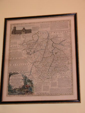
Map of Cambridgeshire 1777
Emanuel Bowen (1714-1767)
Category
Maps
Date
1777
Materials
Engraving on paper
Measurements
545 x 450 mm
Order this imageCollection
Anglesey Abbey, Cambridgeshire
NT 513682
Summary
An Accurate Map of Cambridgeshire divided into Hundreds, by Eman'l Bowen, Geographer to his late Majestie, 1777. Printed for Robert Sayer and John Bennet, Fleet Street, John Bowles, Cornhill, and Carrington Bowles, St Paul's Churchyard. Vignette of Ely Cathedral, and a hunting, shooting and fishing scene. Scale of British Statute miles, 69 to a degree. Coloured in outline. Black and gilt frame.
Provenance
Bequeathed to the National Trust by Huttleston Rogers Broughton, 1st Lord Fairhaven (1896-1966) with the house and the rest of the contents.
Makers and roles
Emanuel Bowen (1714-1767)
