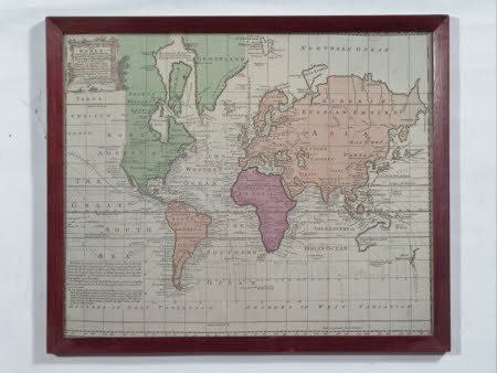
'A new and accurate chart of the World'.
Emanuel Bowen (1714-1767)
Category
Maps
Date
1742
Materials
Paper
Measurements
390 mm (Width); 330 mm (Length)
Order this imageCollection
Baddesley Clinton, Warwickshire
NT 342505
Summary
Framed copy of a map of the world, 'A new and accurate chart of the world', c.1742, by Emanuel Bowen.
Provenance
Item donated 1996 by volunteers Derek and Doreen Watson (Because School Room is closed, phoned donor to offer it back - but he doesn't want it).
Marks and inscriptions
Drawn from Authentic Surveys/ assisted by the most approved/ modern Maps and Charts and regulated/ by Astron/ observations/ whereon are described Lines/ showing the Variation of the/ Magnetic Needle according to/ observations made by several Ex-/perienced Navigatons about the/ year 1742 - by Eman:Bowen/ Geographer to His Majesty.
Makers and roles
Emanuel Bowen (1714-1767), cartographer
