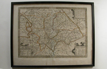
Map of Staffordshire (STAFFORDIAE COMITATVS)
William Smith (1711-1787)
Category
Maps
Date
1670
Materials
Ink and wash on paper
Measurements
4150 mm (H); 530 mm (W); 435 mm (H); 555 mm (W)
Order this imageCollection
Wightwick Manor, West Midlands
NT 1287870
Summary
Print; Engraving, hand coloured. An early detailed map illustrating the county of Staffordshire, showing rivers, towns, villages, churches, castles and gentleman's houses. Borders highlighted in coloured washes. Glazed in narrow black wood frame.
Marks and inscriptions
Sould by John Overton at the White Horse neare the fountaine tavern/Printed and sould by P Stent. (printed)
Makers and roles
William Smith (1711-1787)
