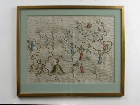
Map of part of Shropshire and Staffordshire
William Hole (d.1624)
Category
Maps
Date
1612
Materials
Ink and watercolour on paper
Measurements
245 mm (H); 320 mm (W); 335 mm (H); 400 mm (W)
Order this imageCollection
Wightwick Manor, West Midlands
NT 1287869
Summary
Print; Engraving, hand coloured. An early map illustrating the rivers in the area of Shropshire and Staffordshire, represented with naked maidens. Various other figures include shepherds, farmers and members of the aristocracy. Details picked out by hand in watercolour. Green card mount; glazed in narrow giltwood frame.
Marks and inscriptions
William Hole 1612 For Michael Drayton Polyolbion. (written in pencil on reverse)
Makers and roles
William Hole (d.1624), artist
