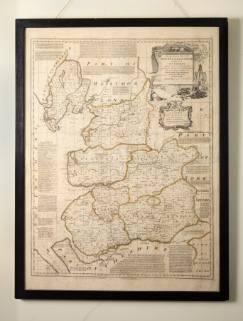
Map of the County of Lancaster
Carington Bowles (1724 - 1793)
Category
Maps
Date
1700 - 1800
Materials
Paper
Measurements
760 mm (H)560 mm (W)
Place of origin
England
Order this imageCollection
Speke Hall, Merseyside
NT 1196101
Summary
Monochrome engraving of the county of Lancaster divided into its hundreds, in seven parts the boundaries highlighted in pink, yellow and green washes. Surrounded by Cumberland, Westmorland, Yorkshire and Cheshire.
Marks and inscriptions
To the Right Hon.ble Edw.d Stanley Earl of Derby Lord Lieutenant for the COUNTY OF LANCASTER. The MAP is Dedicated by his Lordships most humble Obed.t Serv.t Eman Bowen (in cartouche)
Makers and roles
Carington Bowles (1724 - 1793), engraver and publisher Emanuel Bowen (1714-1767), artist Robert Sayer (1725-1794), engraver and publisher
