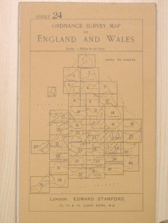
Map No. 24. Cambridgeshire
Ordnance Survey (England, Scotland, Wales)
Category
Maps
Date
1909
Materials
Linen and cardboard
Measurements
110 mm (Width); 177 mm (Length)
Place of origin
Long Acre
Order this imageCollection
Tyntesfield, North Somerset
NT 11848.26
Summary
Ordnance survey map No. 24, Cambridgeshire. One of 40 ordnance survey maps of England numbered 1 to 40, coloured and printed on linen with beige card covers on front and back. Printed on the front cover at the top, SHEET 2 / ORDNANCE SURVEY MAP / OF / ENGLAND AND WALES / SCALE / 2 miles to an Inch. On the bottom, LONDON EDWARD STANFORD, / 12, 13 and 14, LONG ACRE, W.C. On the reverse is a price list for maps of Scotland, Ireland, France, Belgium, Germany, Austria, Italy, and Norway. The maps are located in a storage pouch in the lid of the brown leather case (NT11848.1) for the storage of forty Ordnance and Survey maps.
Provenance
Purchased from the estate of the late Lord Wraxall with the assistance of the NHMF and donations from members and supporters.
Makers and roles
Ordnance Survey (England, Scotland, Wales) , maker Stanford's Ltd. , map publisher
