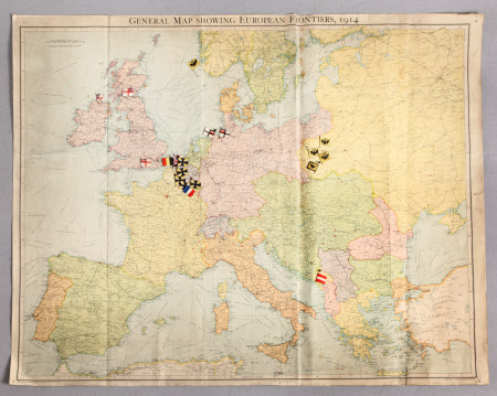
General Map Showing European Frontiers, 1914
John George Bartholemew (1860-1920)
Category
Maps
Date
1914
Materials
Paper, linen, metal and plastic (?)
Measurements
570 x 715 mm
Order this imageCollection
Dunham Massey, Cheshire
NT 937286
Summary
"The Strand" War Map of Central Europe. Colour, paper, general map showing European frontiers, 1914, with small paper flags attached to metal pins with black or white heads stuck through the map in various places. Fold-out map mounted on cloth. Copyright John Bartholemew & Co./The Edinburgh Geographical Institute. A small collection of the flags are contained in a black cardboard box containing 'The Practical Typewriter, No. 2' (DUN/TOY/285).
Provenance
Stamford collection; devised to the National Trust by Roger Grey, 10th Earl of Stamford (1896-1976).
Makers and roles
John George Bartholemew (1860-1920), cartographer Edinburgh Geographical Institute , cartographer
