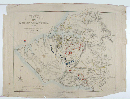
SECOND EDITION STANFORD'S NEW MAP OF SEBASTOPOL, AND THE SURROUNDING COUNTRY. December 1854
Stanford's Ltd.
Category
Maps
Date
Dec 1854
Materials
Paper, ink, watercolour
Measurements
569 x 381 mm
Order this imageCollection
Stourhead, Wiltshire
NT 731303
Summary
Double folio size military map on paper, SECOND EDITION STANFORD'S NEW MAP OF SEBASTOPOL, AND THE SURROUNDING COUNTRY. Edward Stanford, Agent for the Sale of Ordinance Maps, 6 Charing Cross, December 1854. Compiled from the ADMIRALTY new CHARTS & authentic Sketches by CAPT. WETHERALL, D.A.Q.M.G. and other OFFICERS. Referencing position for British, French and Turkish troops, Russian works and the English and French in action.
Makers and roles
Stanford's Ltd. , cartographer
