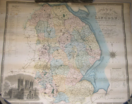
Map of Lincolnshire, surveyed 1827 (after C and J Greenwood and Co)
Josiah Neele (fl.1830)
Category
Maps
Date
Unknown
Materials
Paper
Measurements
550 mm (Width); 800 mm (Length)
Order this imageCollection
Belton House, Lincolnshire
NT 434155
Summary
Hand coloured printed map of Lincolnshire, surveyed 1827- 1828 by C and J Greenwood and Co London. 1831. Engraved by Josiah Neele. The counties parts individually coloured. An engraved view of Lincoln Cathedral is in the lower left corner.
Makers and roles
Josiah Neele (fl.1830), engraver (printmaker) C and J Greenwood and Co [maps] , mapmaker
