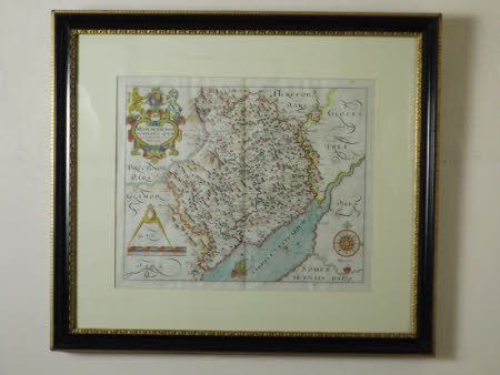
Map of Monmouthshire
William Hole (d.1624)
Category
Maps
Date
Unknown
Materials
Paper and wood
Measurements
485 x 550 x 35 mm
Order this imageCollection
Tredegar, Newport
NT 1553490
Summary
Map. A coloured Latin map of Monmouthshire, also showing parts of Brecon, Glamorganshire and Gloucestershire. In the top left hand corner is a coat of arms, flanked by a lion and a unicorn, underneath that is a scale and in the bottom right hand corner, a set of three red circles with a rose and starred compass design in the centre. The map rests within a black rectangular frame with gilt interior and exterior edges.
Provenance
Part of the collection on loan to the National Trust from Newport Museum and Galleries
Marks and inscriptions
Top left of print: Beati Pacifici/Monumenthensis/Comitatus Quem/Olim Incoluerunt/silures Top left of print: Beati Pacifici/Monumenthensis/Comitatus Quem/Olim Incoluerunt/silures Lower: Christopher Saxton descripsit. Gulielmus Hole sculpsit
Makers and roles
William Hole (d.1624) William Saxton
