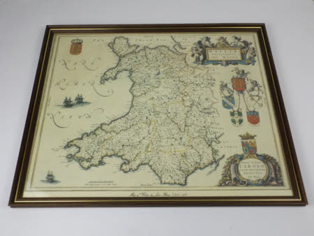
Map of Wales
Joan Blaeu (1596-1673)
Category
Maps
Date
Unknown
Materials
Paper, oak and glass
Measurements
430 x 532 x 20 mm
Order this imageCollection
Tredegar, Newport
NT 1553424
Summary
Map. A map of Wales, by Joan Bleau (1645-62), showing Wales bordered by the Irish Sea to the North and West. In the top left corner is the English coat of arms with a coronet, and on the right hand side, the coats of arms of the four Welsh Dioceses. Mounted in an oak frame with gold border.
Provenance
Part of the collection on loan to the National Trust from Newport Museum and Galleries. In March 2012 the National Trust took over the management of Tredegar House with its contents and its 90 acres of gardens and parkland, from Newport City Council for a period of 50 years.
Marks and inscriptions
Top right: Wallia / Principalvs / Vulgo Wales Bottom right: Serenmo Domino / Carolo / Magnae Britanniae, t / c / Principi / loh blaeu
Makers and roles
Joan Blaeu (1596-1673)
