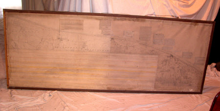
Map of the Coastline from Salthouse to Overstrand with 7 vertical sections showing coastal elevations from Happisburgh to Weybourne.
Ordnance Survey (England, Scotland, Wales)
Category
Maps
Date
1888
Materials
Paper, Wood
Measurements
760 mm (H)1902 mm (W)
Order this imageCollection
Felbrigg, Norfolk
NT 1397884
Summary
Framed map with 2 hanging loops. Photozincograph, 1888, Ordnance Survey. Coastline from Salthouse to Overstrand with 7 vertical sections showing coastal elevations from HAppisburgh to Weybourne. With cuttings referring to geological descriptions stuck onto surface of map. Torn.
Makers and roles
Ordnance Survey (England, Scotland, Wales) , cartographer
