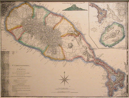
St. Kitts and Nevis
Thomas Jefferys (1720-1771)
Category
Maps
Date
Unknown
Materials
Card
Measurements
275 x 313 mm
Order this imageCollection
Snowshill Manor and Garden, Gloucestershire
NT 1337989
Summary
Coloured landscape map of St Kitts and Nevis, mounted on green card. Compass rose printed below the island. Printed to left 'St. Christophers, or St. Kitts, surveyed by Anthony Ravell Esq. Surveyor General of the islands of St. Christopher, Nevis and Monserrat engraved by Thomas Jefferys Geographer to the King'. Printed label below states: 'St. Kitts and Nevis'.
Provenance
Given to the National Trust with Snowshill Manor in 1951 by Charles Paget Wade.
Makers and roles
Thomas Jefferys (1720-1771), engraver (printmaker) Thomas Jefferys (1720-1771), geographer Thomas Jefferys (1720-1771), cartographer
