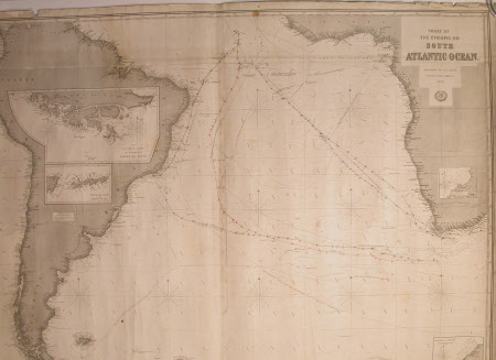
Nautical chart
Richard H. Laurie (1777 - 1835)
Category
Manuscripts and documents
Date
1880
Materials
Paper
Measurements
1090 mm (H); 1261 mm (W)
Order this imageCollection
Snowshill Manor and Garden, Gloucestershire
NT 1337957
Summary
Nautical chart of the South Atlantic Ocean, 1880, R.H. Laurie. Large rolled map. Green label to outside reads 'GRAHAM & PARKES CHRONOMETER MAKERS TO THE ADMIRALTY, WATCHMAKERS, OPTICIANS & c.. 43 CANNING PLACE SOUTHWIDE CUSTOM HOUSE, LIVERPOOL. CHRONOMETERS ACCURATELY RATED AND LENT ON HIRE.' Blue label 'SOUTH ATLANTIC OCEAN. 8S. R.H. LAURIE'. Navigation courses marked with sightings to South Africa and South America in black and red ink. Chart title 'CHART OF THE ETHIOPIC OR SOUTH ATLANTIC OCEAN. PUBLISHED BY R.H. LAURIE No.53 FLEET STREET LONDON E.C. 1880.' R H Laurie logo below. Map was found between RH casement of west window and corner cupboard in Admiral.
Provenance
Given to the National Trust with Snowshill Manor in 1951 by Charles Paget Wade.
Marks and inscriptions
R.H.Laurie
Makers and roles
Richard H. Laurie (1777 - 1835)
