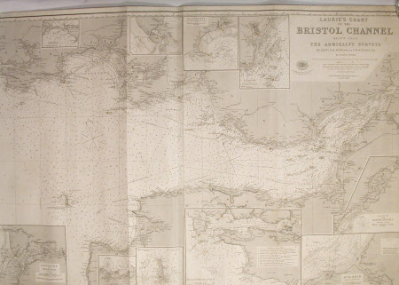
Nautical chart
Richard H. Laurie (1777 - 1835)
Category
Manuscripts and documents
Date
Unknown
Materials
Paper
Measurements
838 mm (H); 1560 mm (W)
Order this imageCollection
Snowshill Manor and Garden, Gloucestershire
NT 1337955
Summary
Nautical chart of the Bristol Channel, R.H Laurie. Rolled Map. Laurie's Chart of the Bristol Channel drawn from the Admiralty Surveys of Capt's H.M. Denham and F W Beechey. RN. By Isaac Purdy London. Published by R H Laurie 1st January 1871 53 Fleet Street. Handwritten in ink across top 'Julius D Hahn May 1871 L'pool'. Cartridge on. Blue sugar paper. Blue label on reverse title and stamped logo for R H Laurie and 8's. Blind embossed stamp W C Cox Plymouth & Devon Port, Optician.
Provenance
Given to the National Trust with Snowshill Manor in 1951 by Charles Paget Wade.
Makers and roles
Richard H. Laurie (1777 - 1835)
