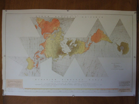
Map of Dymaxion Airocean World
Category
Maps
Date
1954 - 1970
Materials
Paper Ink
Measurements
574 x 903 mm
Order this imageCollection
2 Willow Road, London
NT 112453
Summary
A printed paper map of the world, colour coded to show mean low annual temperatures. This 'special' projection of the world (in which the spherical surface is divided into mainly triangular sectors), cartographed by R Buckminster Fuller and Shoji Sadao and copyrighted in 1954 by RBF (US Patent 2393676). The Raleigh edition of the Fuller projection, available from Excel Corp, 104-01 Metropolitan Avenue, Forest Hills 75, NY USA
Provenance
Bequeathed to the National Trust by Ernö Goldfinger (1902-1987) and Ursula Ruth Blackwell, Mrs Ernö Goldfinger (d.1991), formally acquired in 1994.
